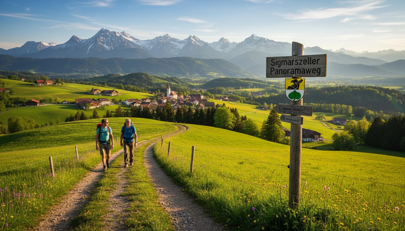
The municipality of Sigmarszell has expanded its hiking trail network with a special attraction. The new Sigmarszell Panorama Trail connects all three districts over a distance of 18 kilometres whilst offering impressive views of the Allgäu Alps and Lake Constance.
"We wanted to create a hiking trail that makes the landscape diversity of our municipality tangible," explains Mayor Jörg Agthe at the official opening. "From the elevated hamlets near Niederstaufen down to the Leiblach plain near Bösenreutin, the trail showcases the full beauty of our homeland."
The circular route starts and ends at the town hall in Sigmarszell, but can be accessed from any district. The route leads through orchards, open forests and past traditional farms. The views from the highest point near Kinberg at 850 metres are particularly appealing. In good weather, the view extends to Lake Constance and the Swiss mountains.
At several stations along the route, information boards provide details about the municipality's history, local flora and fauna, and special natural monuments. An interactive map with GPS data is available for download on the municipality's website.
"The trail is designed to be family-friendly," emphasises local heritage officer Wolfgang Sutter from Niederstaufen, who was involved in the planning. "With moderate inclines and several refreshment options, it is also suitable for less experienced hikers. If desired, the route can also be divided into stages."
The municipality is particularly proud of the nature-friendly route. "We deliberately avoided asphalting and mostly use existing field and forest paths," says Sutter. "This not only makes hiking more pleasant, but also protects nature."
Along the route, local inns invite visitors to stop for refreshments. In Niederstaufen, Sigmarszell and Bösenreutin, there are also several benches and rest areas with panoramic views. The municipality recommends allowing around five to six hours for the complete circuit, including breaks.
The Sigmarszell Panorama Trail can be walked all year round. In winter, the tour is particularly worthwhile when snow envelops the landscape in a white blanket. The trail is also ideally suited for Nordic walking enthusiasts.
Information material about the hiking trail is available at the town hall, at local inns and on the municipality's website. There, interested parties will also find information about parking facilities and connections to public transport.